Stop Juggling Five Apps.
The only community-driven outdoors app. Three worlds, one app — real-time river flows, ocean buoys, tide forecasts, hunting GMUs, land ownership, trail intelligence, and regulations.
Every feature shipped was requested by someone from the community.
The Full Stack,
Deployed.
DriftLine, RidgeLine, and TrailLine are three intelligence worlds inside one app. Water, backcountry, and mountain. One login, one set of favorites, one offline cache — switching from the river to the ridge to the trail is a single swipe.
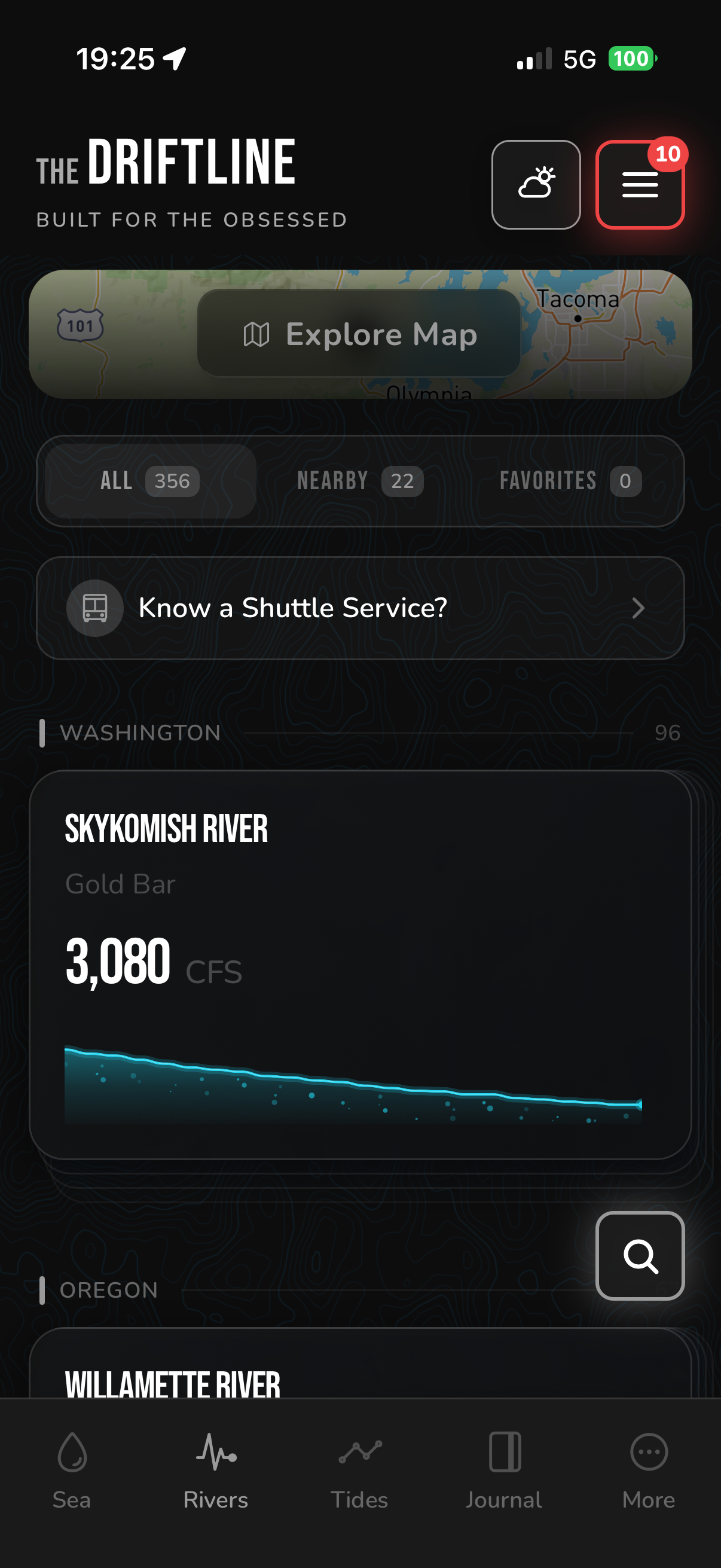
Rivers. Oceans. Tides. Real-time flows from 1,100+ rivers, NOAA buoy feeds, pre-computed tide forecasts, and fishing regulations by zone. Alerts fire when your river hits its window.
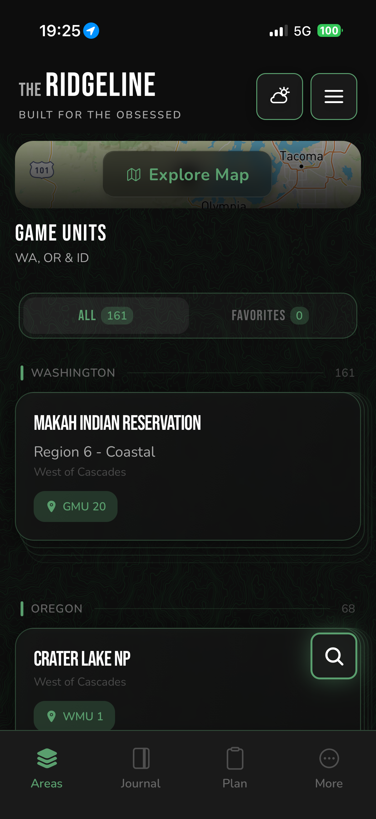
GMUs. Land. Topo. Hunting Game Management Units across 9 western states. Property boundaries. Offline topo maps. Season dates and regulations by unit — no reg book required.
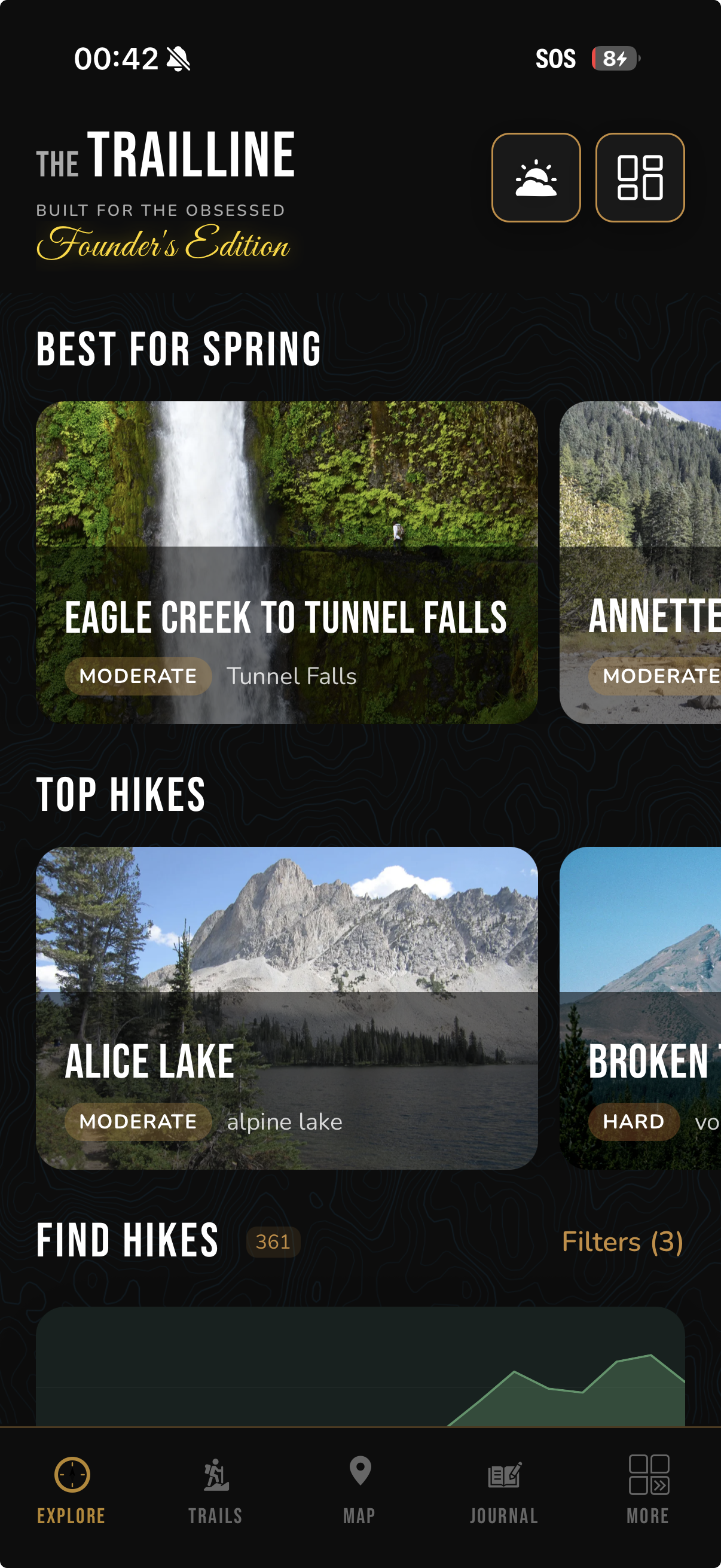
Daylight. Crossings. Weather. Smart daylight planning with pace-aware arrival times, live water crossing intelligence from USGS gauges, and route-aware elevation weather. The safest hiking toolkit on the mountain.
Everything You Need.
Nothing You Don't.
No more flipping between apps on the river or in the backcountry. We built what we wanted and couldn't find anywhere else.
Three Agents.
One Download.
DriftLine for the water. RidgeLine for the field. TrailLine for the mountain. Switch between modes with a single swipe. Everything you need, one glance.
Set It Up In
2 Minutes.
Set your flow level alerts, favorite your lakes, rivers, and hunting areas — and you're good to go.
Favorite
Your Spots
Add the rivers, lakes, and hunting areas you actually use. Skip the noise — only see what matters to you.
Set Your
Alerts
Dial in your "fishable" flow range for each river. When conditions hit your sweet spot, you'll know.
You're
Good To Go
Get the alert, grab your gear. Be on the water while others are still refreshing apps.
One App Replaces
The Whole Stack.
Here's what you're juggling now — and what it looks like with everything in one place.
- onX Hunt$49.99/yr
- onX Fish$34.99/yr
- onX Backcountry$29.99/yr
- AllTrails+$35.99/yr
- USGS · NOAA · NDBCScattered
- Reg Books & PDFsScattered
- River flows, buoys, tides
- Lake fishing & regs
- Hunting units, 9 states
- Land ownership & topo
- 3,250+ backcountry trails
- Daylight & water crossings
Built By Frustrated
Anglers & Hunters.
We're a small crew of outdoorsmen, not some Silicon Valley company guessing what you need.
We know the frustration. You've got river flows on one site, ocean buoys on another, hunting regs buried in a 100-page PDF, and land ownership on yet another app. We burned entire evenings just trying to plan a weekend trip.
So we built what we wanted. One app that puts everything in your pocket — flows, buoys, GMUs, property lines, and regs. Built by guys who actually use it every week.
We're a small crew of outdoorsmen, not some Silicon Valley company guessing what you need. Your feedback directly shapes what we build next. Got an idea? We're listening.
DRIFTLINE = Rivers + Ocean. Real-time flows, buoy data, forecasts, fishing regs.
RIDGELINE = Hunting. GMU maps, land ownership, offline topo, hunting regs.
TRAILLINE = Hiking. Smart daylight planning, live water crossings, route-aware elevation weather.
This is your chance to shape it. Join early and help us build the app you actually want.
Common
Questions.
Fast answers to what anglers and hunters ask before they switch.
How much does it cost?
What states do you cover?
Does it work offline?
How is this different from onX or AllTrails?
How often is data updated?
Can I request a new river or feature?
Ready To Simplify
Your Next Trip?
Join 2,000+ outdoorsmen who stopped juggling apps.